Maps of the North Carolina Coast and Outer Banks
If you are planning a fishing trip to the Outer Banks or North Carolina coast, one of the first things you are going to need is a good map. The following Outer Banks maps and maps of the NC coast are great resources, but be careful before using them for navigational purposes. Either a good GPS, the Electronic Navigation Charts (ENCs) listed below, or ideally both, can provide much more accurate data to keep you on track and off the shoals.
Online Nautical Charts for the NC Coast & Outer Banks
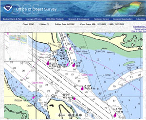
One new tool we recently found is NOAA'a Online Nautical Chart Viewer. It's very easy to use, highly accurate and just what you'd hope it would be. Below are the links for the North Carolina coast and Outer Banks:
Approaches to Cape Fear River
Cape Fear River Cape Fear to Wilmington
New River Inlet to Cape Fear
Intracoastal Waterway Neuse River to Myrtle Grove Sound
New River;Jacksonville
Cape Lookout to New River
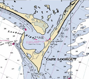
Portsmouth Island to Beaufort, Including Cape Lookout Shoals
Beaufort Inlet and Part of Core Sound;Lookout Bight
Morehead City Harbor
Pamlico Sound Western Part
Ocracoke lnlet and Part of Core Sound
Neuse River and Upper Part of Bay River
Intracoastal Waterway Albermarle Sound to Neuse River;Alligator River;Second Creek
Pamlico River
Cape Hatteras-Wimble Shoals to Ocracoke Inlet
Cape May to Cape Hatteras
|
|
|||||
|
|
||||
|
|
|||||
|
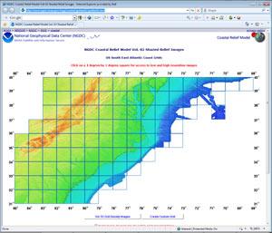
NOAA Digital Maps of the North Carolina Coast
|
|
||||
|
|
|||||
|
National Geophysical Data Center
|
|
||||